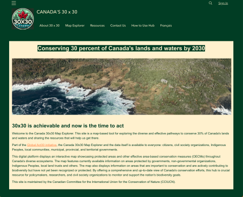
This site is a map-based tool for exploring the diverse and effective pathways to conserve 30% of Canada's lands and waters and sharing the resources that will help us get there. This digital platform displays an interactive map showcasing protected areas and other effective area-based conservation measures (OECMs) throughout Canada's diverse ecosystems. The map features currently available information on areas protected by governments, non-governmental organizations, Indigenous Peoples, local land trusts and others. The map also displays information on areas that are important to conservation and are actively contributing to biodiversity but have not yet been recognized or protected.
CSLA Resource Library
Welcome to the CSLA Resource Library! Explore a wide range of landscape architecture-related research, reports, tools, videos and more—searchable by keyword, topic or type.
Have a resource you'd like to see included? Contact our team to share your suggestion.
Watershed Health and Resilience Indicators
2025 – Paper

SFU-ACT
Watershed Health and Resilience Indicators: Strengthening Indigenous Co-Governance and Low Carbon Resilience in Canada's Watersheds compares nine western and seven Indigenous-led watershed assessment frameworks to better understand indicators used to evaluate watershed health; it supports the advancement of more holistic and place-based understanding of health and resilience in Canada’s watersheds. The research illustrates how Indigenous Knowledge systems and co-governance arrangements can support timely place-based strategies for ensuring the resilience of the ecological, cultural, and societal benefits that flow from healthy and resilient watersheds to communities.
Canadian Register of Historic Places (CRHP)
2025 – Tool

Canada's Historic Places
Federal, Provincial and Territorial (F/P/T) governments recognize the contribution historic places make to our communities. Since 2001, the F/P/T governments have worked together through an initiative to jointly develop core programs. The Canadian Register of Historic Places (CRHP) provides a single source of information about all historic places recognized for their heritage value at the local, provincial, territorial and national levels throughout Canada.
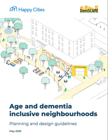
Age and demntia inclusive neighbourhoods: Planning and design guidelines
2025 – Paper
Happy Cities / DemSCAPE
This document offers a toolkit of urban planning and design strategies to support wellbeing for older adults, with an added focus on people living with dementia. This document considers the needs of both older adults and people living with dementia, with clear strategies and actions that can support wellbeing for people of diverse ages, abilities, and life experiences. The guidelines can help municipalities, developers, community-based services, and individuals make informed decisions and advocate for more age-friendly, dementia-inclusive communities. The actions focus specifically on the role of the built environment in supporting wellbeing at three scales: the neighbourhood, the street, and detailed design.
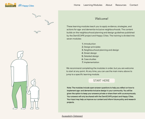
Age and demntia inclusive neighbourhoods: Learning Modules
2025 – Online Course
Happy Cities / DemSCAPE
These learning modules teach you to apply evidence, strategies, and actions for age- and dementia-inclusive neighbourhoods. The content builds on the neighbourhood planning and design guidelines published by the DemSCAPE project and Happy Cities. The training is divided into seven modules: Introduction, Design principles, Neighbourhood planning and design, Street design, Detailed design, Case studies, and Implementation.
Biodiversity Net Gain: A Path to Scalable Ecological Restoration | Alexandra Steed
2025 – Webinar

CSLA/AAPC
With ecological collapse looming large—potentially surpassing the threat of climate change—it’s clear that humanity’s alteration and exploitation of landscapes pose the greatest danger to global biodiversity. Landscape architects play a vital role in reversing this trend by planning and designing places that promote ecological resilience.
In this webinar, landscape architect Alexandra Steed will explore Biodiversity Net Gain (BNG), a framework for enhancing biodiversity through development. Drawing from her 20 years of experience in the UK and internationally, she will discuss practical approaches for scaling BNG, offering real-world examples. This session will provide tools for creating landscapes that restore and support biodiversity while contributing to global regeneration and climate adaptation.
Thursday, June 19, 2025 at 2:00 ET
The Climate Atlas of Canada
2025 – Tool

Prairie Climate Centre
The Climate Atlas of Canada is an interactive tool for citizens, researchers, businesses, and community and political leaders to learn about climate change in Canada. The articles, maps, and videos in the atlas tell a compelling story: climate change is here, it’s a serious challenge, and we can take action. The atlas can help you make sense of climate change.
Cripping Climate Adaptation
2025 – Paper

Prairie Climate Centre
Disability Justice and Climate Change. Because of multiple intersecting factors, people with disabilities are more vulnerable to the health effects of climate change and could be disproportionately impacted during extreme weather events. Inequalities exacerbated by climate change could be addressed and prevented, by ensuring a full and effective participation of disabled persons in climate action at all levels. This report by the Prairie Climate Centre conveys the perspectives on Disability Justice at the intersection of climate change, as expressed by participants at the event: Cripping Climate Adaptation.
Working With Nature as Normal
2025 – Presentation

CSLA/AAPC
Joanna Eyquem discusses progress and examples of efforts to mainstream consideration of nature-based solutions, ranging from strategic approaches and technical guidance, to integration in municipal management and financial reporting. Presentation slides with resource links
Mapping vulnerability and exposure to extreme heat waves
2025 – Tool

Université Laval
The objective of this project is to develop an interactive online mapping application which provides accurate information about the geographic distribution of the vulnerability and exposure of major Canadian communities to heat waves while also specifying, for each geographic unit, the intensity of these weather events. In our view, such tools give the public meaningful and context-appropriate information for a geographic analysis of the vulnerability of communities living in Canada’s major urban centres. With this information, public authorities will be better equipped to deal with heat waves and the health effects they can cause.
Parks in Action | Fadi Masoud
2025 – Webinar

CSLA/AAPC
Presented by Fadi Masoud, Parks in Action highlights the role of parks, open spaces, and the public realm in fostering climate action in Toronto. Urban green spaces range from expansive ravine networks to pocket gardens and from street rights-of-ways to schoolyards and green roofs. Regardless of their scale, they are valuable tools for urban climate change mitigation and adaptation. Toronto’s parks fulfill essential social and environmental prerogatives, including mitigating urban heat island effect, supporting biodiversity, and improving air quality. Similarly, they offer crucial water management goals and reduce the impact of extreme weather events. Well-designed parks also act as inclusive gathering places, fostering social interaction, health, and well-being. “Parks in Action” aims to demonstrate how climate action in the public realm is also generative of participatory design and social engagement—from the scale of small local installations “hubs” to “tower communities” along urban watersheds. Central to this work is the link between social equity and climate adaptation—ensuring that all communities, regardless of their socio-economic backgrounds, have equal access to green infrastructure and their benefits.
This webinar is offered through landADAPT: A new continuing education program to promote building capacity through professional development opportunities for Canadian landscape architects, supported by Natural Resources Canada’s Climate Change Adaptation Program.
i-Tree Eco
2025 – Tool

United States Department of Agriculture Forest Service
Eco v6 is a model that uses tree measurements and other data to estimate ecosystem services and structural characteristics of the urban or rural forest. Eco is a complete package that provides: Sampling and data collection protocols - For plot-based sample projects, total population estimates and standard error of estimates are calculated based on sampling protocols. For complete inventories, eco calculates values for each tree. Flexible data collection options – Use the mobile data collection system with web-enabled smartphones, tablets or traditional paper sheets. Automated processing - A central computing engine that makes estimates of the forest effects based on peer-reviewed scientific equations to predict environmental and economic benefits. Reports - Summary reports that include charts, tables and a written report.