CLIMATE ISSUE: Fluvial (riverine) flooding; More frequent and intense storm events; Ecological degradation | SECTOR: Landscape architecture; Green infrastructure; Ecology and hydrology | STAGE: Initial planned project completed; New projects added under construction | TYPE OF ACTION: Ecosystem-based flood protection; Wetland habitat restoration | TYPE OF SETTING: Coastal wetland / Freshwater shoreline environment
Project Overview

The Niagara River Coastal Wetland Restoration (NRCWR) Program represents a binational effort between Canada and the U.S. to restore coastal wetlands along key areas of the Niagara River. In Canada, these efforts are led by the Niagara Parks Commission (NPC) under the Remedial Action Plan (RAP) which aims to remove the Niagara River from the Great Lakes: Areas of Concern, through a series of nature-based restoration initiatives on both the Canadian and U.S. sides of the river. Using bioengineering techniques and renaturalizing the river edge, the NRCWR Program will not only improve water quality and see the restoration of essential riparian habitat, but also establish erosion protection along the degraded shoreline.
Location: City of Niagara Falls; Town of Fort Erie, Ontario
Actors: Harrington McAvan Ltd. (Landscape Architects); The Niagara Parks Commission (client, project management); Ontario Ministry of Natural Resources (project champion); Niagara Peninsula Conservation Authority (project management)
Funding Agency(s) / Programs: (Varies by project) The Niagara Parks Commission, The Niagara Peninsula Conservation Authority, Ontario Ministry of Natural Resources, Parks Canada, and Environment and Climate Change Canada; Gonder’s Flats Wetland – Ducks Unlimited Canada, Ontario Land Trust Alliance, Niagara Community Foundation, and Land Care Niagara
Issue: Fluvial (riverine) flooding; Habitat degradation; Biodiversity loss; Shoreline erosion; Poor slope stability
Action: Restore coastal wetlands along key areas of the Niagara River using bioengineering techniques and the renaturalization of the river edge to improve water quality, restore essential riparian habitat, and establish erosion protection along the degraded shoreline
Results: Ecological regeneration; Ecosystem-based flood protection; Creation of habitat; Shoreline erosion protection; Biodiversity recovery; Community Development; Public amenities and recreation
Case Study Lead: Niagara Parks Commission
Project Background
In 1987, the Niagara River was designated as one of the 43 Great Lakes: Areas of Concern, prompting the development of a federal–provincial initiative known as the Niagara River (Ontario) Remedial Action Plan (RAP) aimed at improving water quality and ecosystem health. However, it was not until 2015 that the NRCWR Program began taking shape, following a fisheries assessment conducted by the Ontario Ministry of Natural Resources (MNR) which revealed significant declines in fish populations linked to the loss of nearshore vegetation. More than 75% of critical shoreline habitat had been lost due to poor land management practices. In response, the MNR and the NPC initiated a collaborative effort under the RAP to restore the degraded habitat and support ecological recovery along the Niagara River shoreline.
Around the same time, through a partnership between the NPC and the State of New York, Steve Barnhart (landscape architect at the NPC) was invited to visit restoration projects underway on the U.S. (New York) side of the Niagara River. This visit was instrumental, allowing NPC to observe the successes and challenges of those initiatives, providing both technical insights and inspiration for the implementation of similar efforts on the Canadian side. While the project initially focused on restoring fish habitat, it later evolved into a larger nature-based restoration initiative to support biodiversity recovery and establish climate resilience along the degraded shorelines of the Niagara River.
Understanding and Assessing Impacts
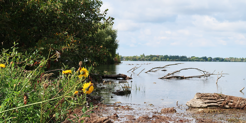
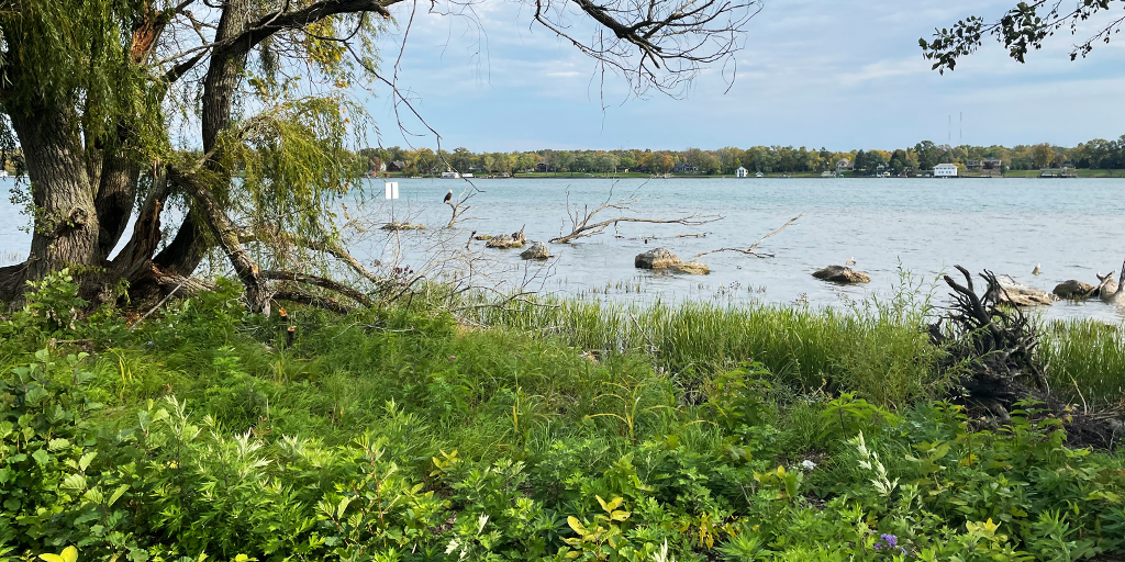
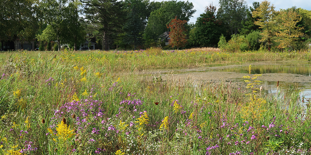
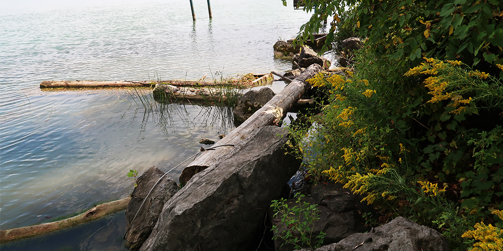
Historically, the upper Niagara River shoreline from Fort Erie to Niagara Falls was lined with ecologically rich coastal wetlands consisting of submergent and emergent aquatic vegetation that provide critical habitat for wildlife. The Niagara River experiences significant fluctuations in water levels due to variable conditions in Lake Erie, where wind patterns exert major influence on surface elevation. To slow the rate of erosion caused by these fluctuations, the shoreline was hardened with large boulders and other structural materials over time, resulting in the loss of natural nearshore habitat, particularly those critical for fish and aquatic species. This presented an opportunity to soften and restore the natural shoreline features by implementing a nature-based design approach that reduces flooding and erosion risk, while also enhancing ecological functions by reestablishing native vegetation and wildlife habitat.
In addition to the reintroduction of native plant species, the NRCWR Program also places a strong emphasis on invasive plant management, with the overall goal of building a resilient shoreline and improving environmental quality and ecosystem function. In terms of climate resilience, project success is measured through the monitoring of species as ecological indicators – more specifically, the recovery of native fish populations and the return and strengthening of native plant communities.
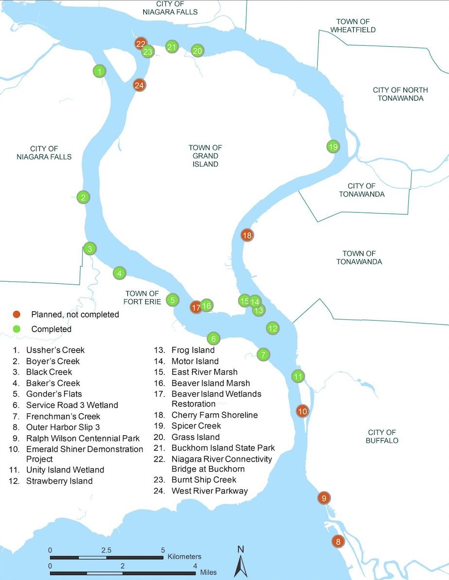
In 2019, the Habitat Restoration Plan developed by the New York State Department of Environmental Conservation, outlined approximately 100 acres of primarily shallow water/coastal wetland habitat critical for restoration on the U.S. side of the river. A shoreline assessment for the Canadian side was conducted in 2021 revealing that approximately 23% of the Niagara River Canadian shoreline has been hardened. This assessment identified seven locations along the upper Niagara River as ideal sites for coastal wetland restoration based on feasibility, site characteristics, and location. In 2021, a riparian study as part of an overall evaluation of the Upper Niagara River identified an additional 26 sites over a 10 km stretch strictly for riparian habitat improvement and management actions such as reduced mowing, invasive species removal, and planting of native vegetation.
Use of Climate Information in Decision-Making
Climate data and projections directly influenced project decisions, particularly in species selection and habitat creation. Ecological data was provided by the MNR, which guided the development of fish habitat to establish long-term resilience. The NPC updated its ‘5-10-20 diversity formula’ (used in the development of planting plans to ensure that the species composition includes a maximum of 5% plants from the same species, 10% of the same genus, and 20% of the same family) to include a mix of plant species better adapted to evolving climate conditions and reduce the risk of a single stressor (e.g., disease outbreak) decimating the entire ecosystem. Throughout the project the selection of plant species were adjusted accordingly to reflect projected shifts in climate zones.
At the outset, modeling of current and future wave action along the shoreline was completed using various climate projection models for Lake Erie. This analysis revealed wave activity reaching heights of up to 1.5 metres, which prompted the consideration for nature-based solutions to be used to absorb and dissipate the wave energy. These measures protect the shoreline, enhance fish habitat and simultaneously deliver community benefits. Early design decisions were also guided by clear evidence of environmental change in the Niagara River, including rising water temperatures, unpredictable flooding, and declining species diversity. Biodiversity loss, in particular, emerged as a concern expected to intensify with projected and ongoing warming of lake waters.
Identifying Actions
With increasing climate pressures on aquatic ecosystems, the NRCWR Program was initiated to address the decline in coastal wetland habitat, improve biodiversity and water quality, and create a resilient, nature-based shoreline capable of withstanding extreme weather events through the strategic use of native vegetation. Biodiversity recovery was established as a key performance target under the Beneficial Use Impairment (BUI) framework, with an objective of achieving a 75% vegetated shoreline. The BUI framework established clear recovery goals that guided the project by outlining ecosystem indicators and environmental benefits (and others relating to the economy and human health) provided by the Great Lakes.
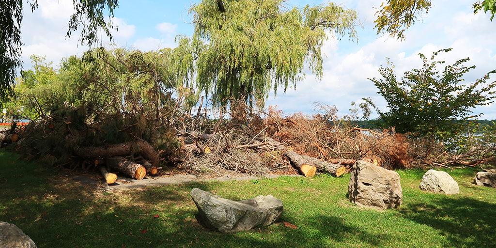
Based on concept designs developed in 2015 by landscape architect Glenn Harrington (Harrington McAvan Ltd.), a central design intention was to mimic natural shoreline systems by anchoring trees and native vegetation along the river’s edge. This approach was intended to create calmer nearshore areas that support fish nursery and spawning habitats, provide shade and shelter, moderate water temperatures, and protect aquatic life from climate-related stressors. The anchored vegetation comprises repurposed dead ash trees that succumbed to the invasive Emerald Ash Borer across Niagara Parks lands, as well as recycled Christmas trees donated by the community. The Urban Forestry Management Strategy (2018) later reinforced these restoration principles by formalizing practices to regularly retain fallen trees for the delivery of the projects.
Despite the clear ecological and climate rationale for restoring the shoreline – enhancing flood absorption, cooling capacity, and biodiversity recovery – public perception required a targeted response during the planning phase to address concerns over the aesthetics and the fears that the development of a coastal wetland would result in increased mosquitoes, odour, or a loss of usable green space. To help overcome these concerns, a proactive public education and consultation campaign took place, during which communications efforts emphasized the vital ecological services and long-term climate benefits provided by naturalized landscapes. By also showcasing successful restoration sites, particularly on the U.S. side of the Niagara River, the narrative gradually shifted from seeing these areas as “untidy” or “neglected” to recognizing them as living systems essential for climate adaptation, biodiversity recovery, and community enjoyment.
Summary of design intentions:
- Mitigate the impacts of historical shoreline hardening along the Niagara River, which contributed to ongoing erosion, habitat degradation, and the loss of aquatic species.
- Improve water quality to remove the Niagara River from the Great Lakes: Areas of Concern.
Implementation
Many of the NRCWR sites are strategically located at or near the mouths of creeks which flow into the Niagara River. Using a combination of bioengineered and nature-based techniques was critical to mitigate shoreline erosion, restore nearshore habitat, and capture sediment and seed from these tributaries. While the project initially focused on fish habitat restoration, its scope expanded as other species, particularly birds, began to return throughout implementation, illustrating the interconnections between habitat creation and shoreline protection.
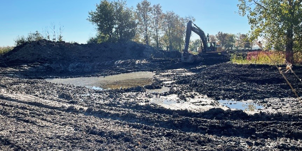
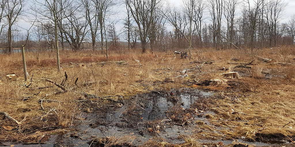
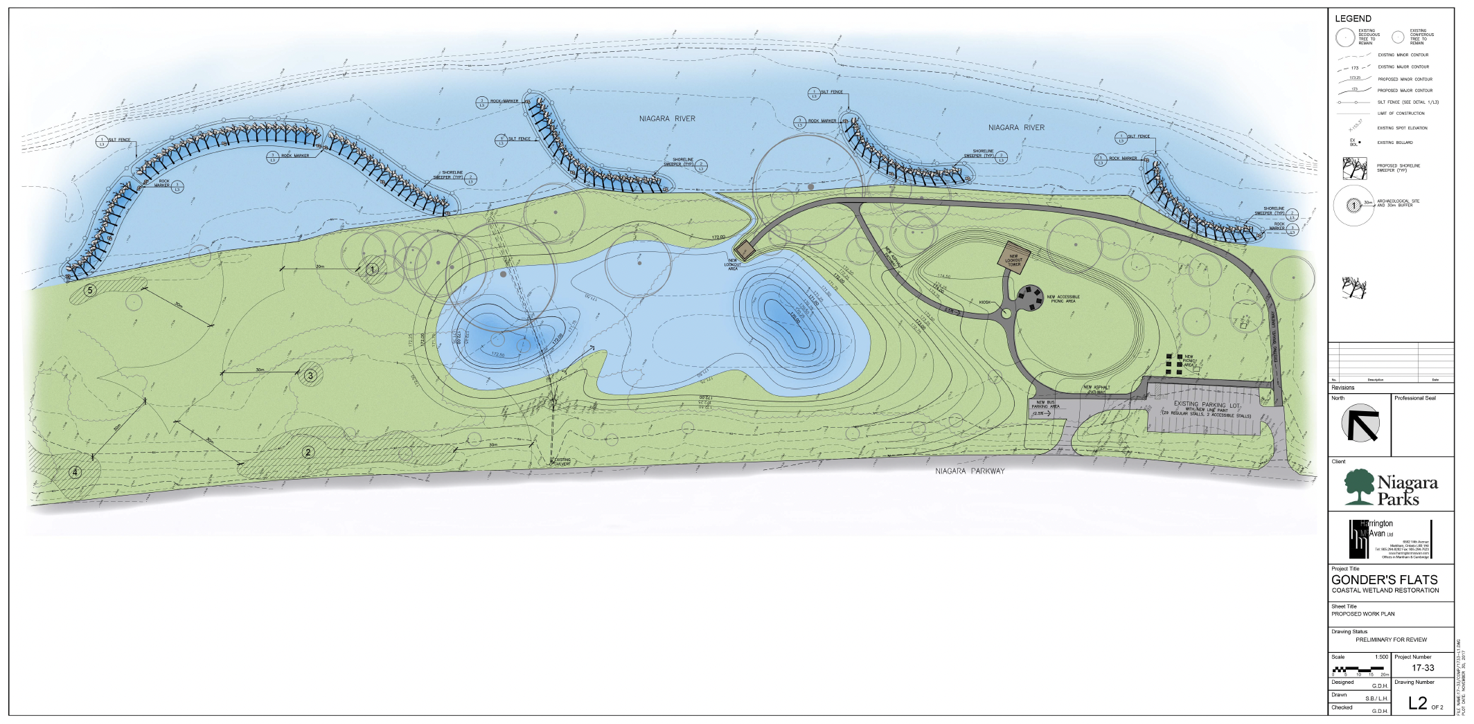
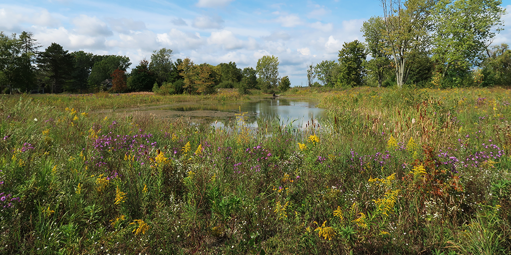
Implementation began with Usshers Creek in 2016, serving as a pilot site that allowed for small-scale testing before broader expansion of the NRCWR program. Usshers Creek was followed by the Gonders Flats wetland (completed in 2018), which serves as an overflow system during high water events by providing a “sponge effect” that supports water retention and habitat restoration while also mitigating road flooding. The Gonder’s Flats project further facilitated refinement of methods and the development of a living dataset to track habitat evolution and resilience under evolving climate pressures.
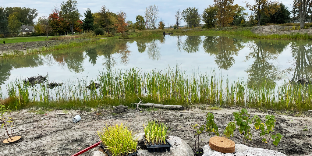
Shoreline restoration actions include the planting of native wildflowers, grasses, shrubs, and trees, serving as living, nature-based alternatives to hardened shoreline infrastructure. Specific plant species were selected for their ability to thrive in wetland environments, improve water quality, and support biodiversity recovery and flood retention. To reduce thermal impacts on aquatic life, vegetation was strategically planted to shade nearshore waters. Harrington’s idea of anchoring trees and large stones, along with root wads and evergreen branches to the riverbed proved highly effective early in the implementation process. This approach successfully slowed water flow, encouraged sediment deposition, and promoted vegetation establishment by creating complex microhabitats that stabilize shorelines and provide shelter for juvenile fish.
Outcomes and Monitoring
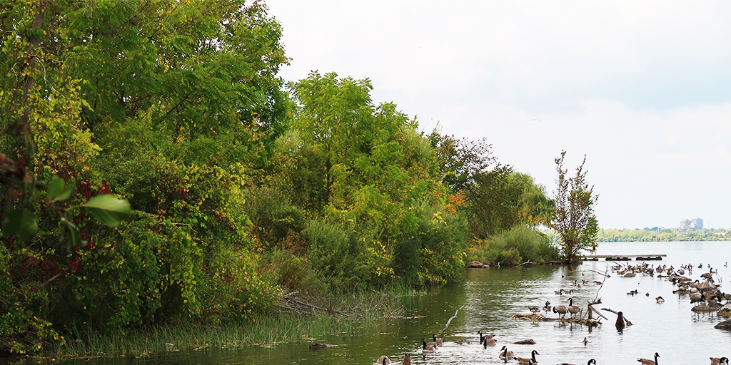
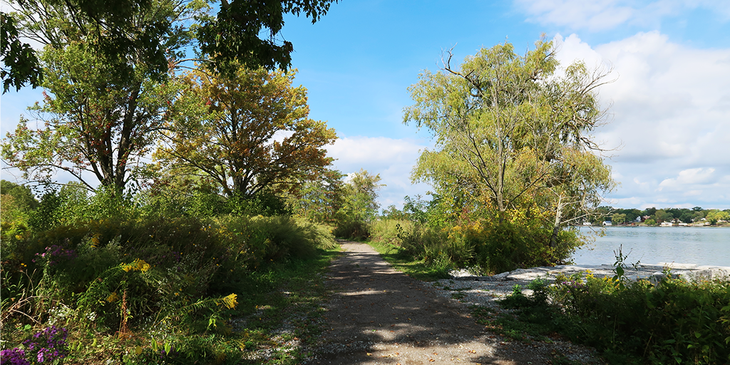
The NRCWR Program has become a model for climate-informed ecological design, demonstrating that restoring natural form and function can achieve adaptation objectives without relying on hard engineering. Through this initiative, eight wetland sites have been restored resulting in five hectares of wetland habitat, nearly two kilometers of restored shoreline, and over 30,000 native trees, shrubs, and wildflowers planted. Biodiversity recovery was immediate and measurable. Fish populations continue to positively respond to the healthier wetlands with native freshwater fish species showing noticeable improvements, including smallmouth bass, muskellunge, walleye and yellow perch. Early results indicate the return of bird species not seen along the river for over 50 years, further underscoring the effectiveness of these naturalization efforts to support biodiversity recovery.
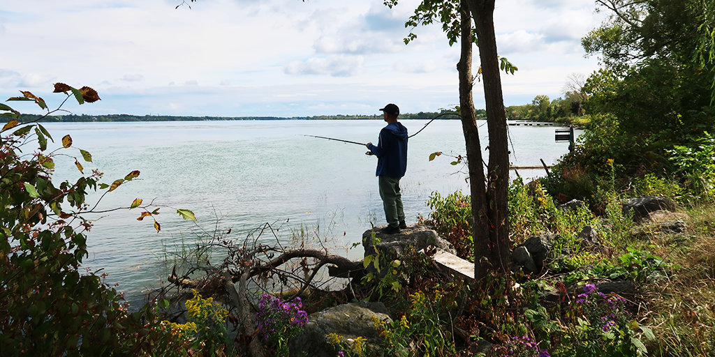
The community response to the NRCWR Program has been overwhelmingly positive, and the benefits are widely recognized, particularly concerning the use of dead trees in the river. Many community members have become champions for the wetlands, providing the NPC with regular wildlife sighting updates and information on additional funding opportunities to expand the program. Citizen science continues to play a central role in monitoring success. Photo-monitoring stations have been added to various locations, encouraging visitors to contribute to long-term observations of habitat recovery via QR-code posts and the iNaturalist platform. Photo stations have also been installed for consistent documentation of changes, further supporting adaptive management and community engagement. A stewardship manual was developed to continue public education efforts and reinforce the role of community in ongoing conservation.
The NPC relies on Fisheries and Oceans Canada (DFO) and MNR for biodiversity monitoring and data collection, conducting baseline and long-term sampling to track species recovery and ecological function. Monitoring and evaluation include visual assessments of plant health and fish presence, and invasive species tracking. Two sites funded by Parks Canada provide ongoing biodiversity recovery data to inform future restoration strategies aligned with the RAP.
The interdisciplinary collaboration and knowledge of the agencies involved, including the MNR and Niagara Peninsula Conservation Authority, were critical to the success of the program. Their coordinated efforts helped communicate the importance of these projects to the public and interested parties, and helped secure financial capital. The partnership with the New York State Department of Environmental Conservation, which is leading the initiatives on the U.S. side of the Niagara River, was also crucial, providing the NPC with key takeaways and opportunities to leverage support based on their success.
Highlights of the Landscape Architect
The landscape architect played a critical role in the successful delivery of the NRCWR Program by bridging design, ecology, and community engagement. Glenn Harrington, the lead landscape architect on the project, introduced a key innovation – anchoring dead ash trees lost to the Emerald Ash Borer into the Niagara River as low-cost, adaptive habitat structures. Harrington also developed concept and construction designs, and identified suitable wetland sites, including the inland wetland of Gonders Flats site. He led communications with senior management, partners, and other interested parties to build understanding and support. Harrington’s work illustrates the integrative role of landscape architects in translating ecological objectives into climate-adaptive landscapes that are functional.
As a landscape architect with the NPC, Steve Barnhart also played a central role in the successful delivery of the NRCWR projects, championing the initiative from the outset to the NPC to secure the necessary support and approval from senior staff. These contributions are significant given that this initiative exceeded the scope of any prior work completed by the NPC in regards to environmental restoration. Steve also helped to ensure successful project delivery by providing oversight on the design elements. His contributions were instrumental to the realization of the project and bringing Harrington’s initial vision to life. Along with Barnhart, Harrington's vision was later expanded by Rich McAvan, having since influenced the NPC's broader climate adaptation strategies by demonstrating how nature-based solutions can advance biodiversity recovery, shoreline resilience, and community use simultaneously.
Next Steps
Initially considered complete, the NRCWR Program's outcomes and community advocacy have resulted in ongoing expansion. Recently, two additional sites have been identified and are in the early stages of shoreline restoration. Research collaborations with Brock University are also underway to document the program's outcomes and impacts on hydrology, vegetation succession, and ecosystem function under changing climate conditions. Ongoing efforts also include refining the species diversity formula tailored to soil conditions and microclimate variability, and continued monitoring of fish and plant populations.
Future work will emphasize education and community engagement, ensuring that local residents understand and value the restored landscapes as part of the recently adopted Niagara Parks Climate Readiness Action Plan. In 2021, the Delisting Strategy for the Niagara River was developed through collaborative efforts and input from RAP partners, to provide the most up-to-date summary of information about the Niagara River’s remaining BUIs. Currently, there are five beneficial uses still considered ‘impaired’ on the Canadian side of the Niagara River.
Resources
- Niagara Parks (2023) - Niagara River Coastal Wetland Restoration Project - Wetlands PDF
- Niagara Parks - Shoreline Management at Niagara Parks
- Niagara River Remedial Action Plan - Bi-National Restoration Project
- Niagara River Remedial Action Plan - Track the Progress
- New York State Department of Environmental Conservation - Habitat Restoration Plan: Niagara River Area of Concern
- Gouvernement du Canada – Grands lacs: Secteurs préoccupants
- Niagara River Remedial Action Plan – Niagara River (Ontario) Remedial Action Plan (RAP),
- Niagara River Remedial Action Plan – Bi-National 'Habitat' board PDF (2019)
- Niagara Climate Change Action Network – Urban Forestry Management Strategy (2018)
![]()
This case study was prepared and authored by Sabrina Careri (Design Communications) on behalf of the CSLA.
It forms part of the landADAPT Case Study Series, an educational resource and advocacy tool developed by the CSLA with the support of Natural Resources Canada’s Climate Change Adaptation Program.