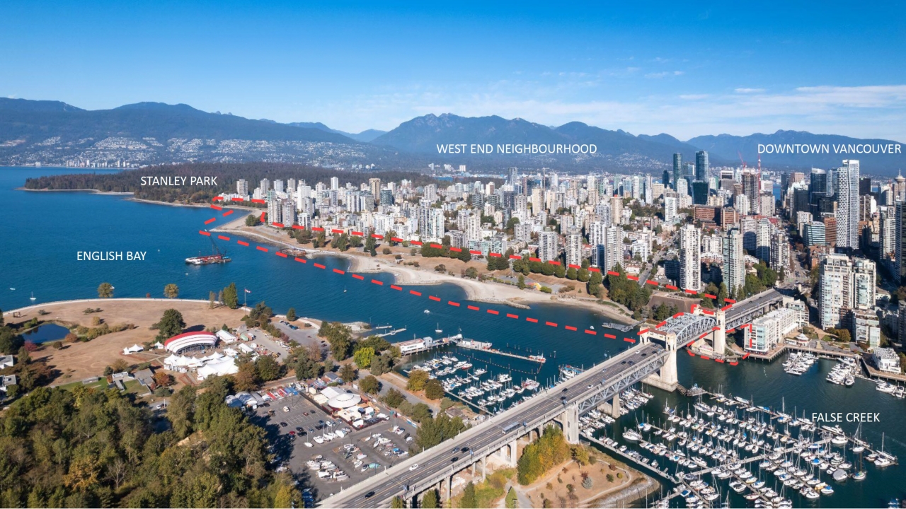
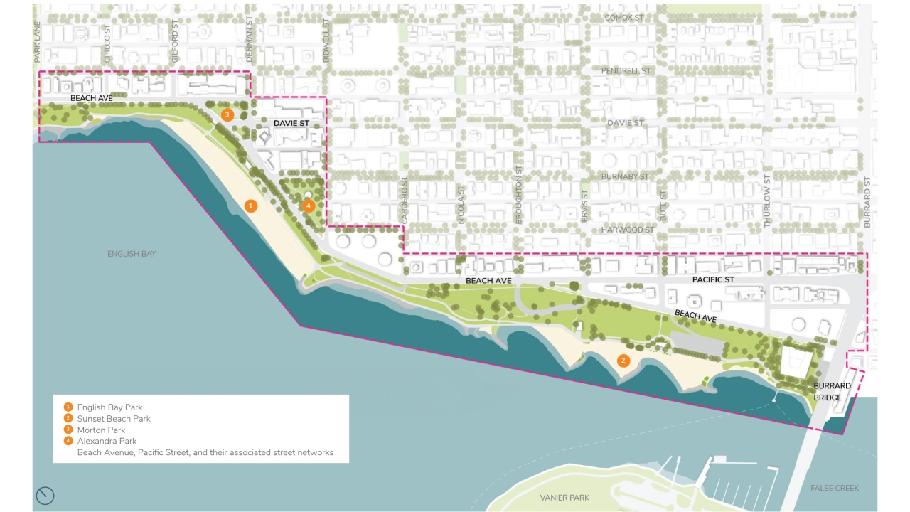
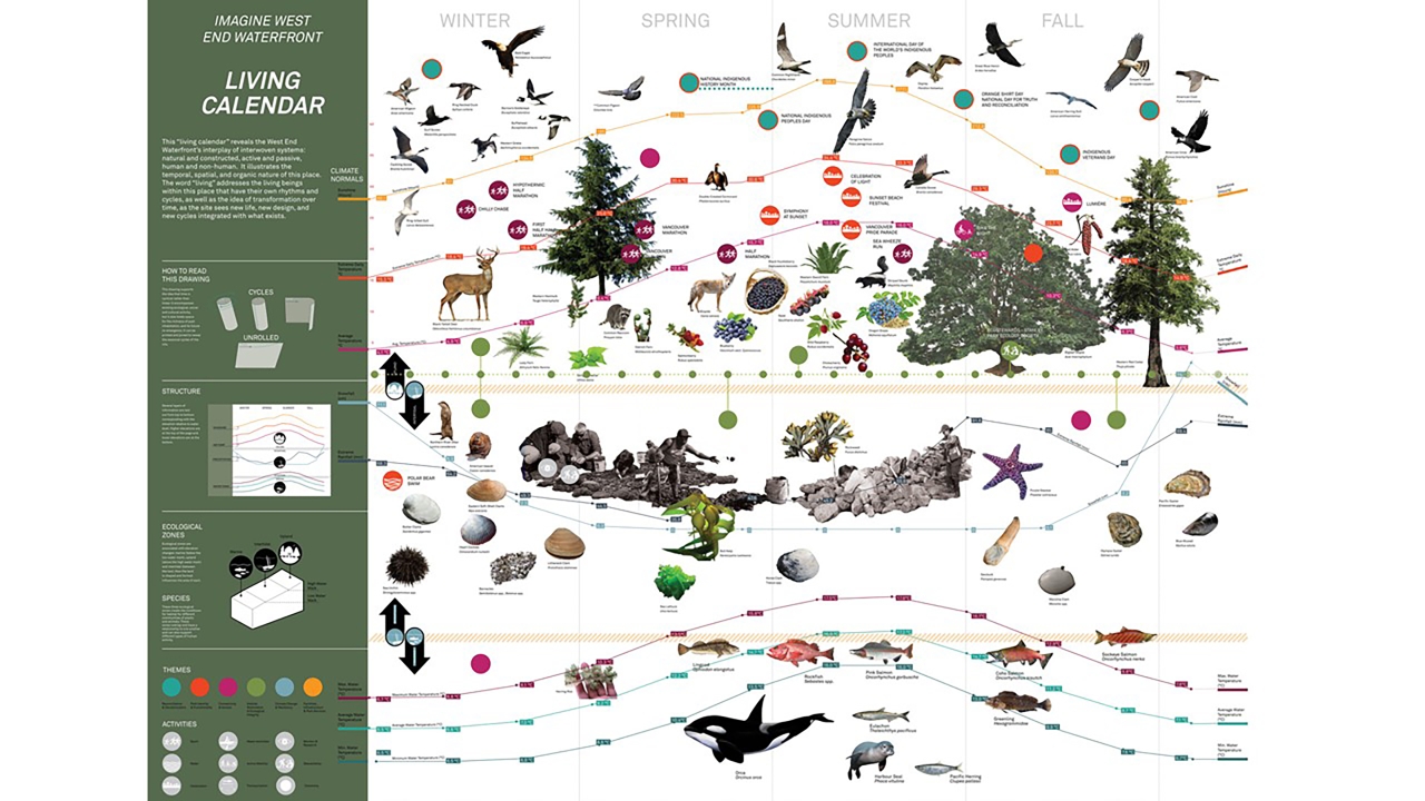
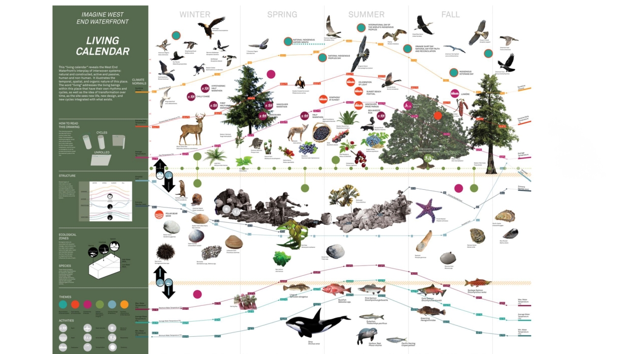
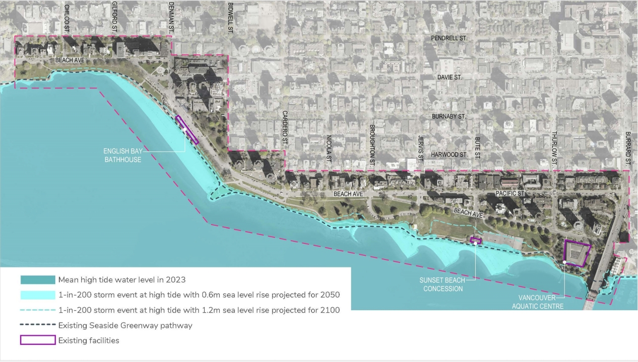
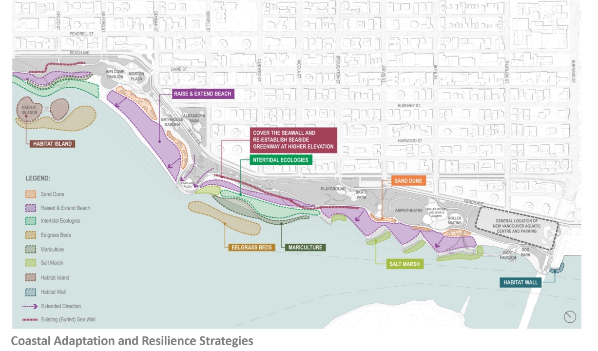
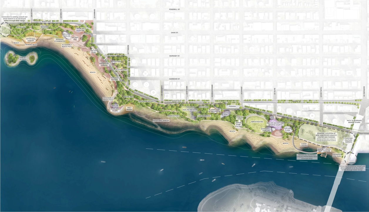
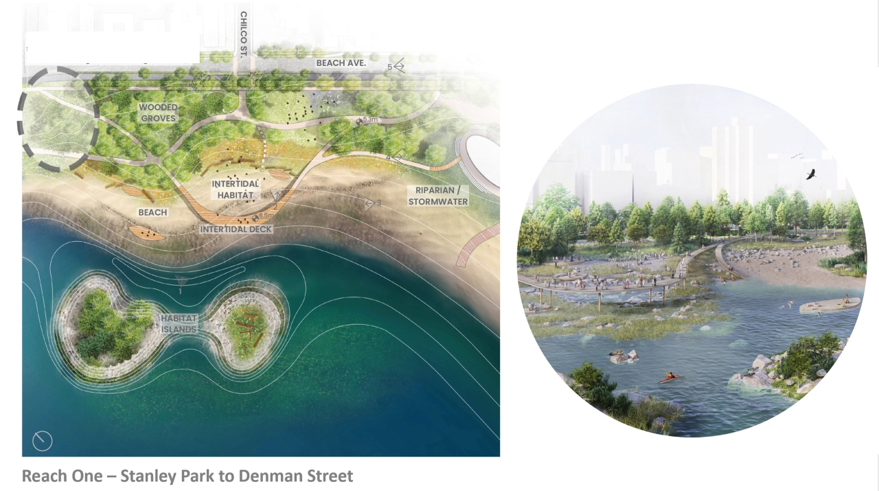
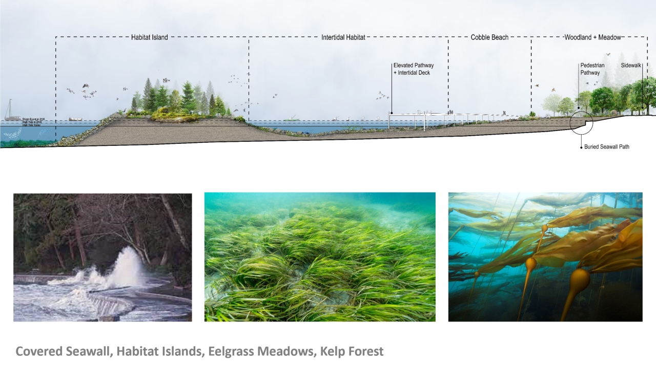
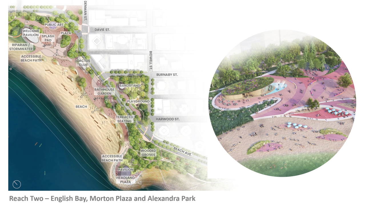
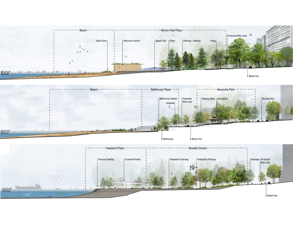
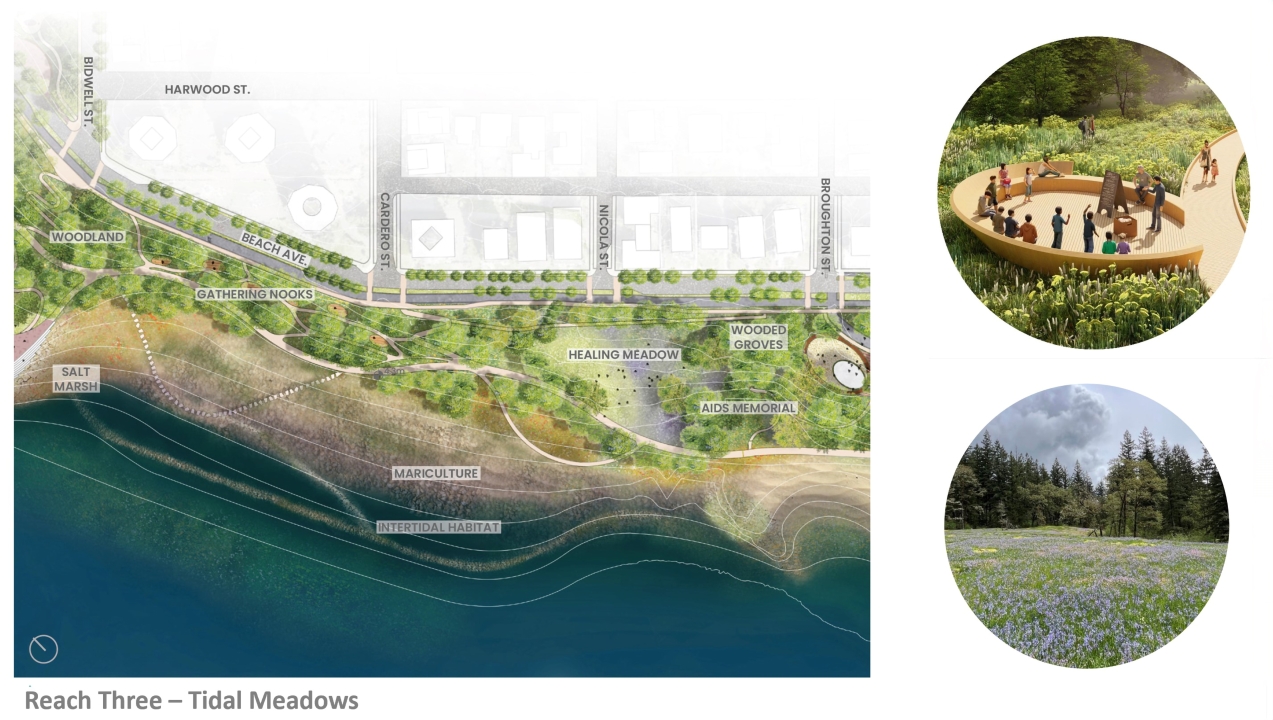
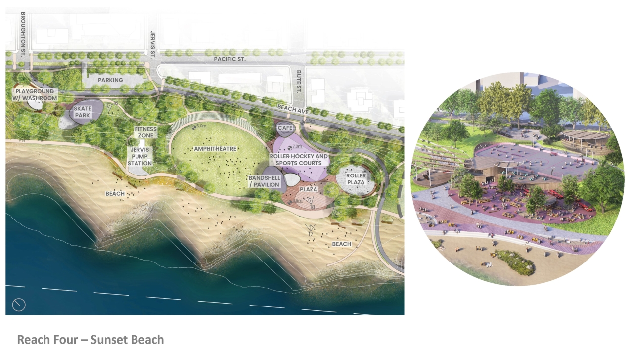
The largest planning project ever undertaken by the Vancouver Park Board, the Imagine West End Waterfront Vision Plan is a 30-year plan for 90 acres of parks, beaches and associated street network on Vancouver’s downtown peninsula. Situated on the unceded territories of the xʷməθkʷəy̓əm, Sḵwx̱wú7mesh and səlilwətaɬ Nations, the plan centers nature-based, transdisciplinary approaches to climate adaptation and sea-level rise based on Coast Salish values, culture and aspirations within the Park Board’s mission of decolonisation. The plan orchestrates the ecological, social, cultural and economic potentials of the waterfront to ensure it continues to be a major civic destination. The landscape architect-led team used design-based approaches to holistically weave together Coast Salish traditional cultural and ecological knowledge, oceanographic dynamics, ecological complexity, foreshore engineering, multi-modal transportation, and the design of diversely programmed public spaces and buildings into a phased, climate adaptive plan. By editing and reconfiguring the sea wall, street and parking network, bicycle and pedestrian paths, buildings and programs, the plan reconnects upland and intertidal zones while expanding programmatic and ecological complexity.