


Quick Facts
Name
Parc Jean-Drapeau
Type of Landscape
Cultural Landscape with composed natural and urban parkland
Location
Composed primarily of two islands in the St. Lawrence River near old Montréal: Île Ste. Hélène, and Île Notre-Dame (created in the 1960s for Expo 67)
GPS 45° 30' 45.76" N, 73° 32' 1.90" W
Stewards
Société du parc Jean-Drapeau
Legacy
Master Planning and Urban Design;
Recreation/Health & Well-Being;
Culture and Heritage

Introduction
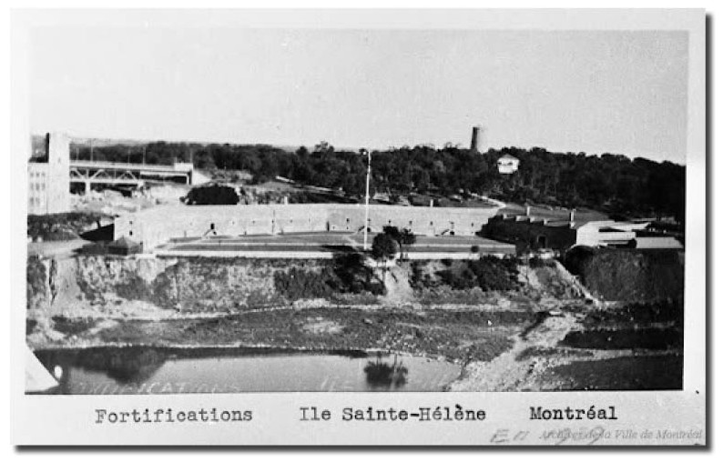
The island landscapes of Parc Jean-Drapeau have captivated visitors to the historic City of Montréal since its earliest days as a French colony. In the early 1600s, Champlain named the beautiful Île Ste. Hélène to honour his young wife. For the next two-and-a-half centuries, the island, which lies in Canada’s St. Lawrence River near old Montreal, was first a French barony, later an English fort.
On St. Jean Baptiste Day, 1874, Montreal finally opened the island to its people, welcoming 6000 picnickers, 600 singers, and 25 bands to the city’s first public park.
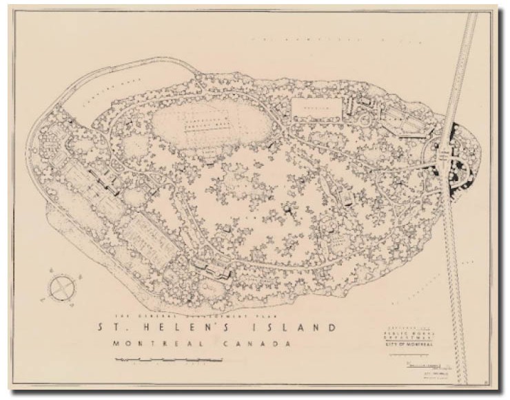
Over the next century, Île Ste. Hélène captured the hearts of generations of Montrealers, including the park’s first designer, the renowned landscape architect Frederick Todd. In the difficult years of the Depression, Todd employed thousands of out-of-work citizens to implement his picturesque design for the park “at the front door to the city.”
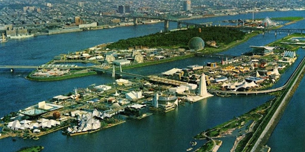
Todd envisioned Ste. Hélène as a larger park, an idea that would bear fruit as the city prepared to host the 1967 World Exposition. Expo 67’s lead site planner, Édouard Fiset, proposed that Île Sainte-Hélène be expanded, and a wholly new island, Île Notre-Dame, created. For decades thereafter, these islands-in-the-making would figure prominently in every episode of Montreal’s storied growth as an international force.
Hundreds of designers descended on the city to create Expo 67s magnificent site design: its visionary pavilions and public spaces, its ultra-modern monorails and metros, and its fluid landscapes blending world-leading technical prowess with design innovation.
| 
|
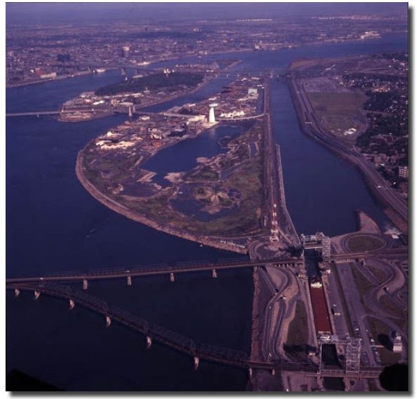
Expo 67 was a triumph on the world stage, and the glory years continued with Île Notre Dame at centre stage. Montréal hosted the 1976 Olympic Games, constructed the 1978 Circuit Gilles-Villeneuve racetrack, and launched the 1980s garden festival, Les Floralies internationales de Montréal. In the 90s, state-of-the-art landscape projects improved the landscape’s health and sustainability.
Today, the value of these invented and natural parklands is engraved in public memory. Montréal continues to fund new work to enrich the value of these inherited landscapes for new generations of Quebecers.
“A Designer at His Peak…” Why Frederick Todd Loved Île Ste. Hélène
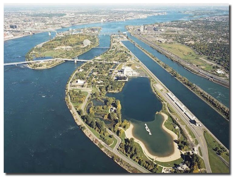
Landscape architect Nancy Pollock-Ellwand, historian, tells the story of Frederick Todd’s “soul-satisfying work” on Île Ste. Hélène. …
“The story of the development of St. Helen’s Island Park is a testament to a designer at his peak, taking on a very complex natural and cultural landscape, on a strategically located urban site. …
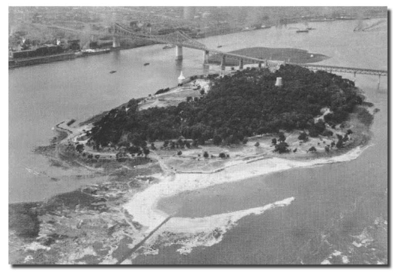
“Revival of interest in this site came about in the 1930’s when the city was planning the construction of a new link across the St. Lawrence, the Jacques Cartier Bridge, which rose above the site. Todd’s work included the creation of a bathing beach; restoring historic buildings which dated from the time of Champlain; and, producing new buildings which included a lookout tower, bath house, and sports pavilion. This Montreal park site was an ambitious plan that tripled in size with landfill from the bridge construction.”
“For Todd, the park was ‘the very front door of the city – a constant mark of welcome to those who come in ships along the mighty St. Lawrence and to those who come by land via the magnificent Jacques Cartier Bridge’.….
“This was also a project with a profoundly important social agenda, employing thousands of out-of-work citizens through the Depression, and upon completion providing much needed recreational space for the urban population of Montreal….
“For the socially-minded Todd, this work gave him great satisfaction. He stated, “in thirty-eight years of experience in planning parks, the writer never had the pleasure of designing and supervising quite such a soul-satisfying work as the St. Helen’s Island Park project.”
Source: The prolific interpreter of the Olmsted vision: Frederick G. Todd, Canada’s first landscape architect. Nancy Pollock-Ellwand. Planning Perspectives, 2019, vol. 34, issue 2, 191-214.
The Accelerators: The Expo 67 Honour Role
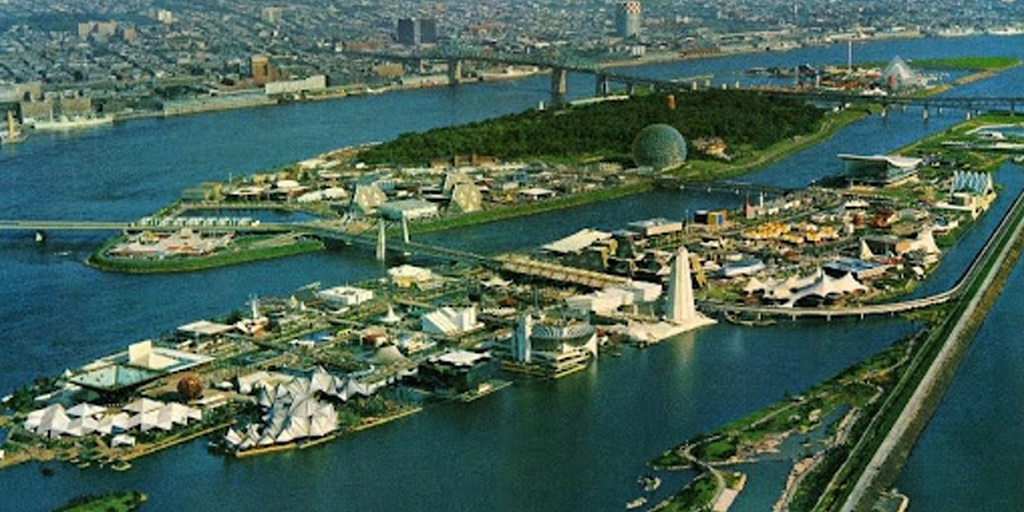
The most game-changing decade in the history of Montréal’s island park began in the early 60s, as the city prepared to host some 50 million visitors during the 1967 World Exposition, Man and His World. With Expo on the horizon, Montreal came alive with design energy, coupled with technical expertise. Scores of landscape architects came together in the city, and with contingents of architects, engineers and urban planners of all sorts, they prepared to transform the city’s image on the international stage.
Just a decade before, Montréal parks director Claude Robillard had engaged McFadzean, Everly & Associates to improve Île Sainte-Hélène’s offerings. The park now boasted functional new amenities from bleachers and picnic shelters, to cultural exhibitions in the military museum, and even a theatre.
The masterplan for the Expo 67 site, commissioned by the Canadian Corporation for the 1967 World Exhibition, was as audacious as it was technically complex. To house the six-month celebration, architect and urban planner Édouard Fiset revived an idea dear to the park’s first designer, Frederick Todd. Île Sainte-Hélène would be expanded, while Île Notre-Dame would be newly created.
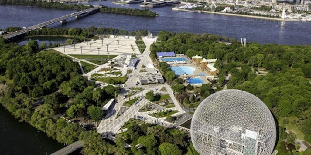
Expo’s modernistic urban environment featured 90 pavilions from 62 nations, clustered around art-filled public spaces and parkland, and connected by futuristic transportation networks featuring a monorail and metro. Buckminster Fuller’s geodesic dome (now the Biosphere) and Moshe Safdie’s Habitat 67 housing (now condominiums) still stand today.
Expo 67 marked a coming of age for landscape architecture in the city and indeed, the country.
- Project Planning Associates Consortium: coordinated the development of pavilions and public spaces
- Sasaki Strong & Associates – James Secord Consortium, Landscape Architects and Site Planners: the La Ronde amusement park
- Don Graham & Associates: designed the lake and walkways on Île Notre-Dame’s southern tip, creating a microcosm of different Canadian landscape types
- Harper–Lantzius Consortium: Cité du Havre
- Louis-Joseph Perron: the Pavilion of Honour’s rose garden, using one thousand rose bushes donated by the Rotary Club
Mayor Jean Drapeau, together with other levels of government, contributed decades of ongoing, often contentious, political support. In 1999, the park was renamed Parc Jean Drapeau.
The success of Expo 67 influenced the design of subsequent expositions in Osaka (1970) and Vancouver (1976). At home, Expo inspired ambitious landscape work across the province and well beyond, including Toronto’s Ontario Place waterfront theme park, 1971. It accelerated Montreal’s standing as a cosmopolitan force, and home to design excellence.
Île Notre-Dame: Every Decade Another Story
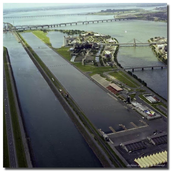
For Île Notre-Dame, the heady Expo years were just the first of many transformations. The glory days continued throughout the 1976 Olympic Games, when Lemay-Leclerc Architectes created the 2-km-long Olympic Basin, a facility stimulating athletes for decades to come. In 1978, Roger Peart’s design of the 4.7 km Circuit Gilles-Villeneuve Formula One racetrack followed the curving shores of the island, shaping the site of the annual Canadian Grand Prix.
In the 1980s, the island became a gardener’s paradise. Four landscape architects from the Montreal Botanical Garden (Alain Baillargeon, Gaëtan Bilodeau, Carlos Martinez and Jean Landry), lined the island’s central canals with gardens for Les Floralies internationales de Montréal (1980). The festival, directed by Pierre Bourque, was a North American first. Many of the gardens remain today.
In the nineties, emerging expertise in sustainable landscape design spurred a re-greening of the park, based on a cutting-edge master plan from Williams, Asselin, Ackaoui. The implementation, coordinated by architect and urban planner Marc London, included shoreline naturalization, an innovative natural water filtration system, and a park beach.

The Cultural Landscapes Legacy Collection highlights the achievements that have made a lasting impact within the field of landscape architecture and on communities across Canada.