


Quick Facts
Name
Don Mills Community Development Plan
Type of Landscape
Suburban township incorporating extensive conservation areas
Location
City of Toronto, North York District
Don Mills Community crossroads: Lawrence Ave. and Don Mills Rd.
GPS: 43° 44' 8.22" N / -79° 20' 21.78" W
Timeline
Initiated in 1953
Stewards
City of Toronto
Designated an Ontario Heritage Site (1997)
Toronto and Region Conservation Authority (TRCA)
Landscape Architects
Macklin L. Hancock (1925-2010), Director of Planning (1953), with assistant Douglas Lee, architect
Legacy
Master Planning and Urban Design

Introduction
In the bustling, heady years following World War II, Metropolitan Toronto became one of the fastest growing cities in North America. As optimistic consumers demanded new automobiles and new homes, industrialist E. P. Taylor decided the time was ripe to create an extensive new suburb.
Taylor owned some 2,058 acres of picturesque land on the Don River, a stunning rolling topography of ravines and valleys. Here, seven miles northeast of Toronto’s downtown, he commissioned Macklin Hancock, a young urban planner and landscape architect still at Harvard, to design a new town.
Hancock’s master plan was a daring departure from the norm. The rapidly-formed Don Mills Development Corporation envisioned a wholly modernist, self-sufficient town for some 35,000 people. The town-to-be, developed solely by private enterprise, would be the first large-scale modern community of Canada’s post-war era.
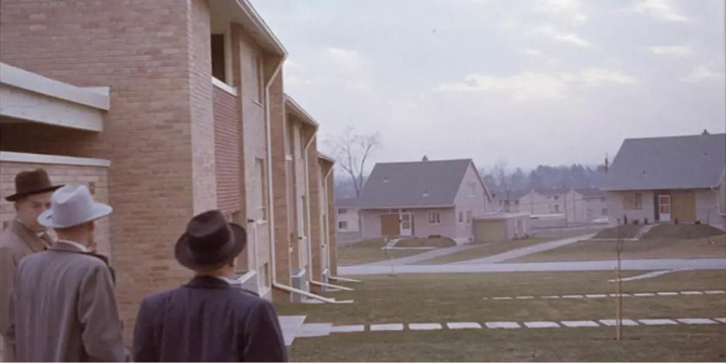
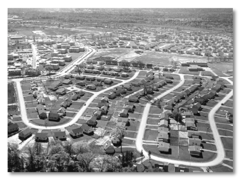
Don Mills was not just another suburb. Hancock embraced the garden city concept, a philosophy drawn from the broad teachings of Sir Ebenezer Howard, in which urban town planners implemented forward-thinking urban reforms. This was a town that accommodated the motor age, with gracious open streets, wide spacious lots, and a generous network of pedestrian walkways and parks separated from busy access roads.
Uniquely, Hancock celebrated the town’s “unbuildable areas”, traditionally neglected in the city, by retaining an inviting greenbelt of forests and ravines. Four neighbourhood quadrants, complete with schools and churches, surrounded a central shopping complex. Architecturally, the town offered a wide variety of award-winning homes of fresh, modern design, built to strict standards. Industrial sectors clustered around the town periphery.
Over some ten years, the town would become the blueprint for suburban development into the future, cementing Hancock’s pioneering impact as a forward-thinking designer and urban planner. Today, Hancock’s Don Mills master plan remains largely intact, an outstanding legacy in urban planning.
How to Grow a City by Building a Town
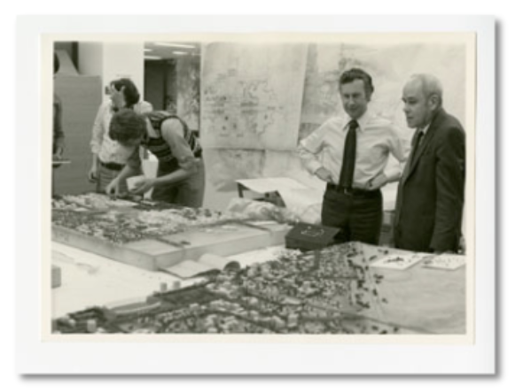
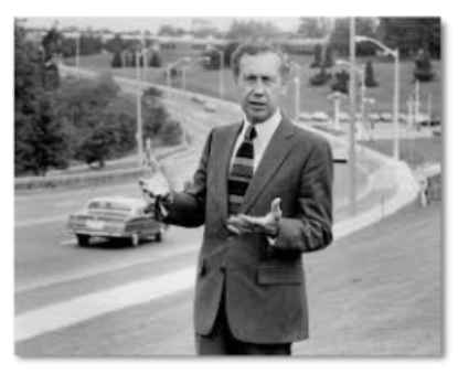
Macklin Hancock’s master plan for the Don Mills community was created when he was just 27. Born in 1925 and a veteran of World War II, Hancock had headed for Harvard University, where he was schooled with fresh and even revolutionary approaches to garden city design and urban planning. Named Director of Planning for Don Mills in 1953, Hancock and his assistant, architect Douglas Lee, planned a model town that would humanize urban life in an age of industry and the automobile.
Don Mills pioneered a new, larger vision for creatively managing city growth. The revolutionary new town sat well beyond the edge of the current urban core. This radical idea for a completely modern, self-reliant townscape, with local employment as part of its matrix, was the precursor to the large private developments of today.
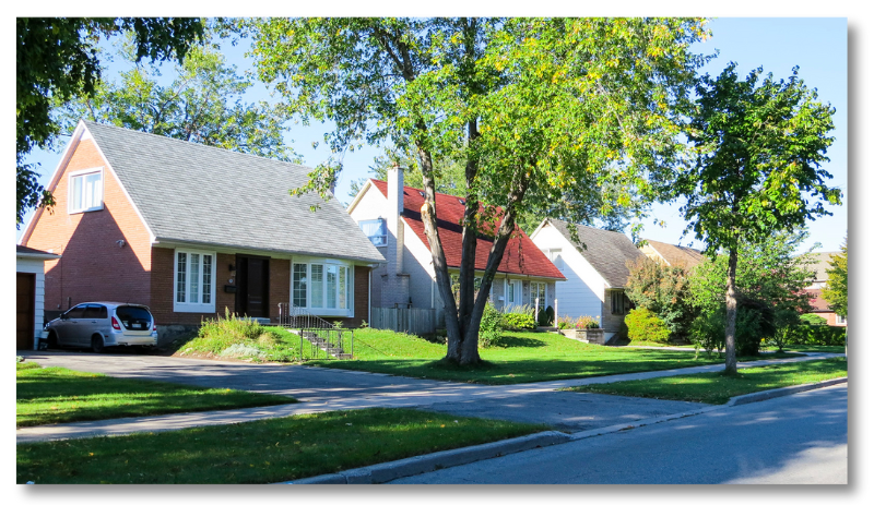
While the landscape itself set the tone, the architecture also set Don Mills apart. No cookie-cutter houses here! Don Mills boasted modernist homes set on wide lots. It offered award-winning and affordable low-rise apartments and row housing, encouraging the growth of a truly mixed-income town.
The designers set local industries beyond the town’s ring road, and carefully sited buildings to protect trees and green space. Walkways provided safe routes through parks to local schools and the town centre. The diversity of housing types, the private and public spaces, and the distinct neighbourhood atmosphere set precedents for new Canadian communities with a strong sense of place.
The principles developed in Don Mills helped Hancock found a game-changing practice. Hancock became a founding member of Project Planning Associates Limited (PPA), and President for more than 45 years. The multi-disciplinary firm provided a launching pad for scores of forward-looking professionals. PPA employed planners and architects, infrastructure and transportation engineers, environmental and socio-economic specialists. This integration propelled a new consulting approach in Canada, with landscape architecture at the master planning helm. PPA alumni, in turn, launched careers and founded state-of-the-art practices across the country.
Testing Ground: Development that sits lightly on the land
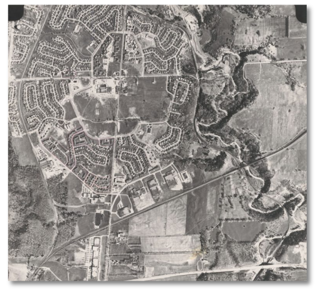
The signature layout of Don Mills, the town’s intertwined network of parks and pathways, the unexpected incorporation of a greenbelt, all created a unique landscape setting and identity for Don Mills. The Hancock plan focused on building community, creating places for contact with nature and social interaction within the open spaces and pedestrian walkways, the civic centres and wild lands.
Hancock read the landscape first, creating street and pathway layouts that allowed children to walk to school without having to cross arterial roads. In the first years of site planning and construction, he made sure that services and utilities were installed with a view to protecting natural features and minimizing grading alterations. His sensitivity to the often-neglected, “unbuildable areas” -- those ravines, woodlots, shorelines and difficult topography -- were critical to the town’s rich ecology. The greenbelt concept, then unique, protected the existing ravines of Wilmet Creek and Don River corridor, close-to-home places that residents still enjoy year-round.
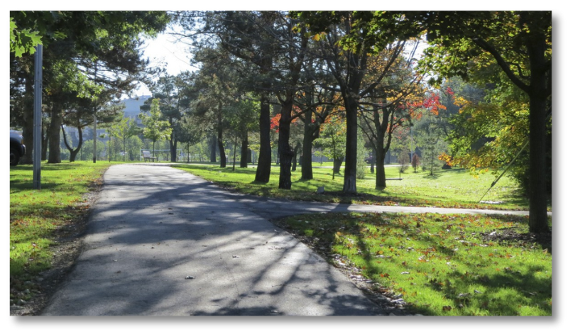
At the time, the importance of preserving the ravines had captured the attention of environmentalists such as Charles Sauriol and the Don River Conservation Authority (later merged with the Toronto and Region Conservation Authority). In time, they would be preserved in public ownership for future generations, setting the stage for park and open space conservation plans in many other sectors of the GTA.

The Cultural Landscapes Legacy Collection highlights the achievements that have made a lasting impact within the field of landscape architecture and on communities across Canada.